Download Data
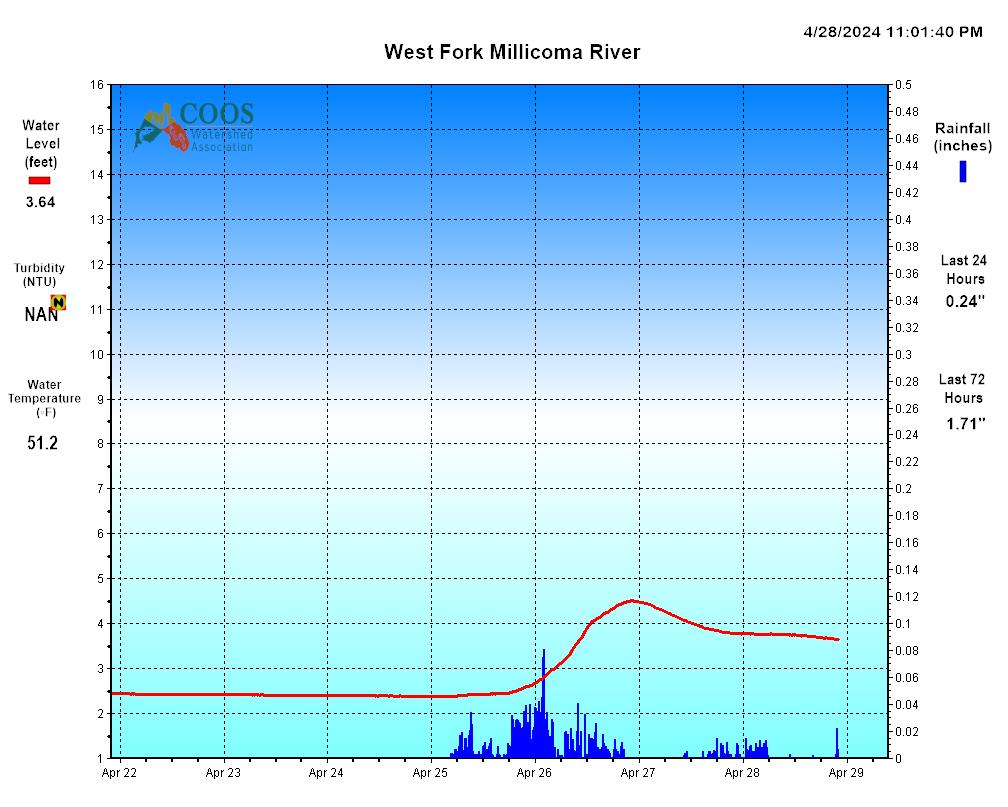
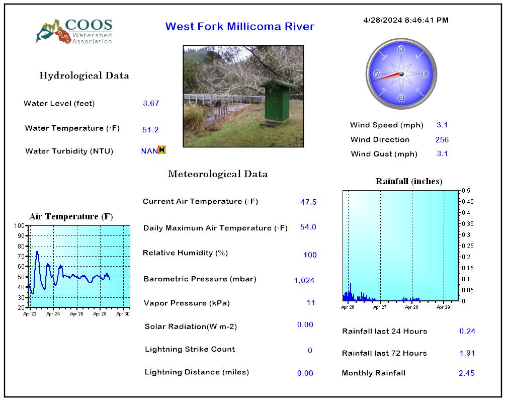
West Fork Millicoma River Gaging Station
Approximately 5 miles from the mouth, near Allegany, Oregon
Station Number: 14324500
Hydrological Unit: 17100304
Latitude: 43.26350 Longitude: -124.31931
Drainage Area: 46.90 square miles
Elevation: 76.95 feet NGVD29
Period of Record: 1955-1981 (USGS), 2003 – Present (CoosWa)
2003 2004 2005 2006 2007 2008 2009 2010 2011 2012 2013 2014 2015 2016 2017 2018 2019 2020 2021
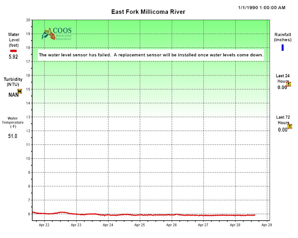
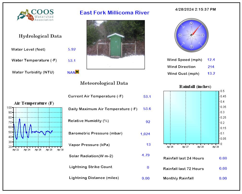
East Fork Millicoma River Gaging Station

Below Glenn Creek, Near Allegany, Oregon
Station Number: 14324100
Hydrological Unit: 1700345
Latitude: 43.45440 Longitude: -123.57340
Drainage Area: 65.32 square miles
Elevation: ~90 feet
Period of Record: 2003 – Present (CoosWa)
2003 2004 2005 2006 2007 2008 2009 2010 2011 2012 2013 2014 2015 2016 2017 2018 2019 2020 2021 2022 2023 2024
Marlow Creek Gaging Station
1 Mile from the mouth, near Allegany, Oregon
Station Number: 14324300
Hydrological Unit: 17100304
Latitude: 43.44510 Longitude: -123.02080 (NAD 83)
Drainage Area: 6.01 square miles
Elevation: ~75 feet
Period of Record: 2003 – Present (CoosWa)
2003 2004 2005 2006 2007 2008 2009 2010 2011 2012 2013 2014 2015 2016 2017 2018 2019 2020 2021 2022 2023 2024
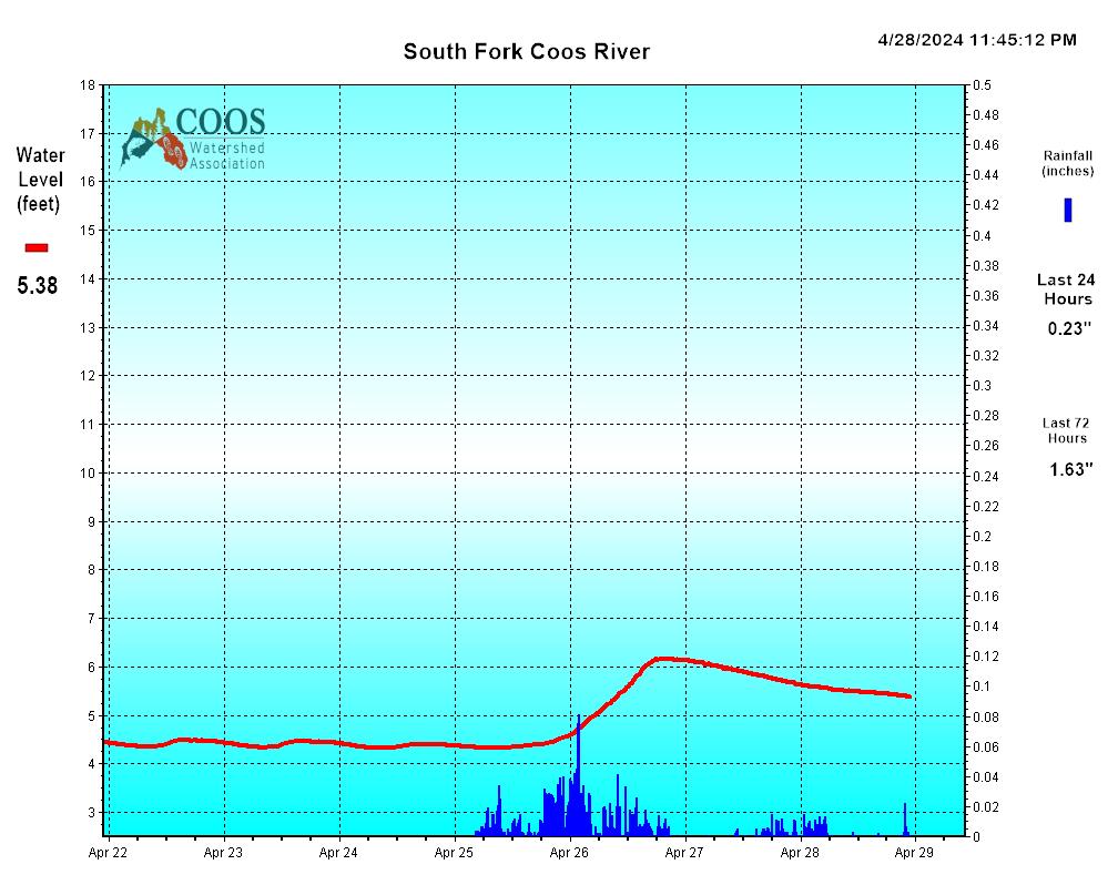
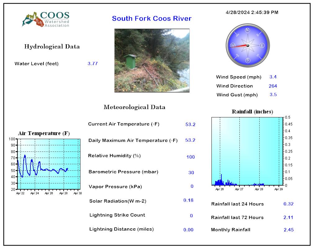
South Fork Coos River Gaging Station
at Seven Mile Bridge, near Dellwood, Oregon
Station Number: 14323600
Hydrological Unit: 14320050
Latitude: 43.376283 Longitude: -123.957640 (NAD 83)
Drainage Area: 210 square miles
Elevation: ~145 feet
Period of Record: 2003 – Present (CoosWa)
2003 2004 2005 2006 2007 2008 2009 2010 2011 2012 2013 2014 2015 2016 2017 2018 2019 2020 2021 2022 2023 2024
Tioga Creek Gaging Station
Station Number: 14323500
Hydrological Unit: 17100304
Latitude: 43.26530 Longitude: -123.81230
Drainage Area: 24.50 square miles
Elevation: ~623 feet
Period of Record: 1982-1996 (OWRD), 2008 – Present (CoosWa)
2009 2010 2011 2012 2013 2014 2015 2016 2017 2018 2019 2020 2021 2022 2023 2024
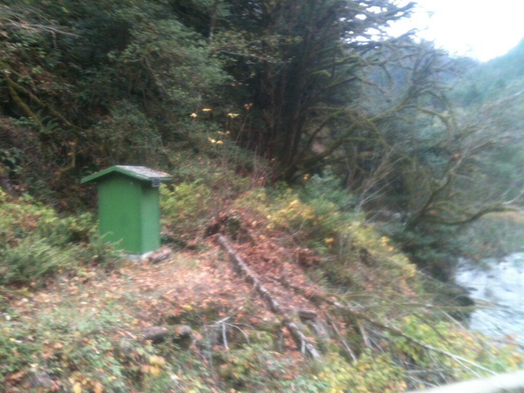
Eel Creek Creek Gaging Station
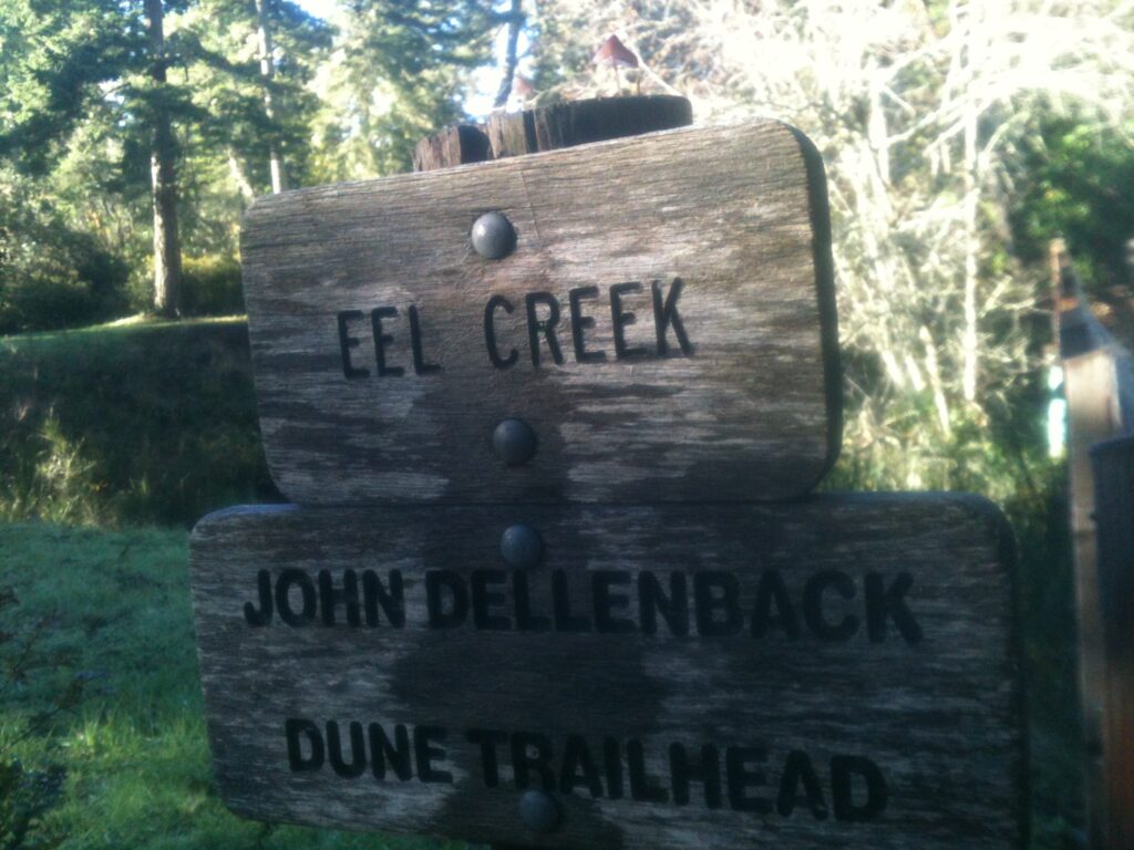
at Lakeside, Oregon
Station Number: 14323300
Hydrological Unit: 17100304
Latitude: 43.57680 Longitude: -124.19291 (NAD 83)
Drainage Area: 10.80 square miles
Elevation: 10 feet
Period of Record: 2007-2013 (CoosWa)
2007 2008 2009 2010 2011 2012 2013 2014 2015 2016 2017 2018 2019 2020 2021 2022 2023 2024
Tenmile Creek Creek Gaging Station
Below Lakeside, Oregon
Station Number: 14323200
Latitude: 43.57600 Longitude: -124.19260 (NAD 83)
Drainage Area: 70.85 square miles
Elevation: ~10 feet
Period of Record: 1958-1976 (OWRD), 2007-2013 (CoosWa)
2007 2008 2009 2010 2011 2012 2013 2014 2015 2016 2017 2018 2019 2020 2021 2022 2023 2024